Regional hiking trails

Here you will find, among other things, a selection of hiking trails of the Eifelverein in the Bitburger Land. The trails are marked with a three-coloured "E" (blue: for sky and water; brown: for earth and soil; green for meadows and forests) on a white mirror; above it "EIFELVEREIN", below it on a green field the name of the trail.

This section also contains a selection of local hiking trails in the Bitburger Land holiday region.

mehr lesen

Share content:

Bitte akzeptieren Sie den Einsatz aller Cookies, um den Inhalt dieser Seite sehen zu können.

Alle Cookies Freigeben
Panoramic view over a green landscape with fog. In the foreground a bench, in the background hills and trees under a cloudy sky., © Eifelverein Ortsgruppe Speicher

Spangweg - circular trail around Speicher

Lenght: 16.4 km
Difficulty: difficult

More information
Historic red brick station building with towers, surrounded by trees and a parked car., © Eifelverein Ortsgruppe Speicher

Bahnhofsweg -Round walk around Speicher

Lenght: 5.3 km
Route: Speicher, Kirchstraße to Speicher, Kirchstraße
Difficulty: easy

More information
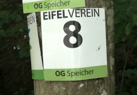
An Eifelverein sign with the number 8 and the inscription 'OG Speicher' is attached to a tree., © Tourist-Information Bitburger Land

Mühlenweg - circular route around Speicher

Lenght: 6.7 km
Difficulty: easy

More information
An old steam locomotive stands under a canopy in front of a brick building. The locomotive is painted black and pink., © Eifelverein Ortsgruppe Speicher

Bähnchenweg - circular trail around Speicher

Lenght: 11.2 km
Route: Speicher, Kirchstraße to Speicher, Kirchstraße
Difficulty: medium

More information
An ivy-covered Lourdes grotto with a gate. Flowers can be seen on the gate. Signs with lettering adorn the entrance., © Eifelverein Ortsgruppe Speicher

Grottenweg - Circular route around Speicher

Lenght: 11.1 km
Route: Speicher, Kirchstraße to Speicher, Kirchstraße
Difficulty: medium

More information
View of Baustert, © Roman KImmlingen

Theme trail Monuments Baustert-Brimingen

Lenght: 10 km
Difficulty: easy

More information