GPS-Spaziergang: Vier-Jahreszeiten-Spaziergang Niederweiler
Niederweiler
SECRET TIP FROM DORIS WELTER
My favorite walk, which never ceases to amaze me with its magnificent views of the varied landscape of my home in the southern Eifel:
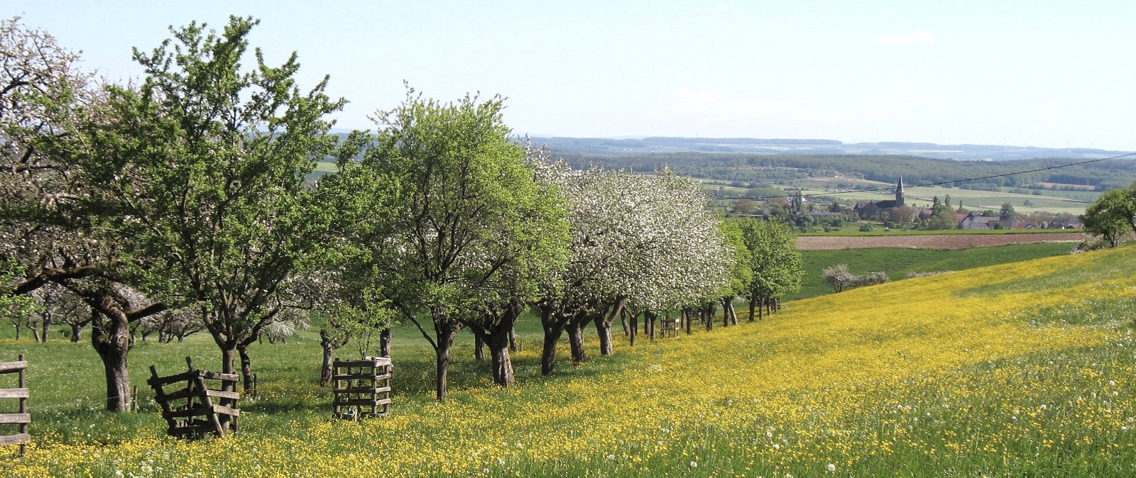
The starting point is at the end of Niederweiler. First walk in the direction of Oberweiler, then after a few meters turn left towards the forest onto the field path. After the small ascent, you soon reach the small Hardt forest and thus the highest point in the Niederweiler district at an altitude of almost 450 meters.Once there, I love to let my gaze wander and enjoy the vastness and diversity of our Eifel landscape: to the west, the trees nestle against the steeply sloping and then rising Prümtal valley, while the villages on the other side seem close enough to touch as the crow flies and yet are far away along the road. To the north, the houses of Oberweiler almost seem to disappear into the nearby fabric forest. The calming green of the forests, the wide fields along the roadside and in the distance and the silence of nature are always like a little immersion in another world for me.
Many a time I have caught a glimpse of a little bunny or a deer scampering across the fields.
If you continue along the tarmac path, you soon see two more villages peacefully to the west on the other side of the deep, wooded valley cut, again miles away, and yet they seem so close. In contrast, if you look to the east, the sight of the highway bridge in Bickendorf is for me a symbol of our fast-moving and performance-oriented times, of noise and hectic, but also of progress and development. As I walk on, I am even more grateful for the quiet, relaxing moments on my wonderful countryside walk.
I reach the Grambüsch and the path descends steeply, and along this small wood on the way towards Niederweiler you can enjoy a long view of the striking neo-Romanesque church of Biersdorf on the upper edge of the village. You soon reach the entrance to Niederweiler again.
For me, this walk of just under an hour is always an opportunity to consciously appreciate the beauty of our local Eifel landscape. Be it in spring, when the shrubs and trees unfurl their leaves and colorful flowers. Or in summer, when the ripe fields and green meadows reinforce the impression of vastness. Autumn is particularly attractive, when the leaves along the two small woods glow in so many colors, and I have often discovered red and white toadstools on the forest floor! The highlight in winter is the partly untouched snow, and the white landscape near and far is simply indescribable!
Please note: This hike is a GPS-only hike and is not signposted on site!
You can download the GPS coordinates as a GPX track to your cell phone and open them in a corresponding app, e.g. Outdoorative,
GPX Viewer .


