Wandern mit Kindern, © TI Bitburger Land

Hiking with children

Short hikes up to 10KM in length

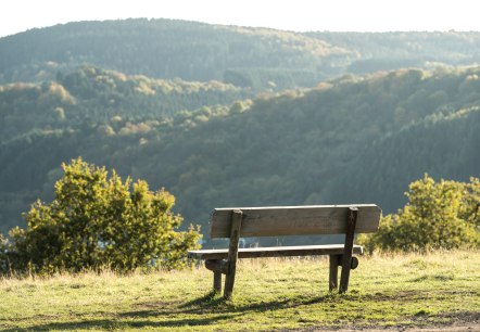
Enjoy the peaceful and idyllic nature of the Bitburger Land holiday region during a hike or a walk with the whole family.

mehr lesen

Share content:

Bitte akzeptieren Sie den Einsatz aller Cookies, um den Inhalt dieser Seite sehen zu können.

Alle Cookies Freigeben
Panoramic view of Gransdorf with houses, green fields and trees under a cloudy sky., © Doris Pauels

Gransdorf G2

Lenght: 4.7 km
Difficulty: easy
Round trip

More information
Village square with a brick church surrounded by colorful houses. A tree in the foreground, cloudy sky in the background., © TI Bitburger Land S.Wagner

Gransdorf G1

Lenght: 5.5 km
Difficulty: easy
Round trip

More information
Wachenforth Chapel, © TI Bitburger Land

GPS-Wanderung: Kapelle Wachenforth

Lenght: 5.8 km
Difficulty: medium

More information
Beautiful forest passages, © NaturAktivErleben

EifelBahnSteig - 17th stage: From Densborn to Usch/Zendscheid

Lenght: 11.3 km
Route: Bahnhof Densborn to Bahnhof Usch/Zendscheid
Difficulty: medium

More information
Logo of the Eifelverein with stylized lines in blue, brown and green. Below it is 'Felsenweg' on a green background., © Eifelverein

Eifelverein - Felsenweg 12. Etappe

Lenght: 19.9 km
Route: Speicher Bahnhofstraße to Kordel
Difficulty: medium

More information
Eifelverein logo with stylized rocks and 'Felsenweg' lettering on a green background., © Eifelverein

Eifelverein - Felsenweg 11. Etappe

Lenght: 25.4 km
Route: Malberg to Speicher Bahnhofstraße
Difficulty: difficult

More information
Pilgrimage church and former rectory in Auw an der Kyll, © NaturAktivErleben

EifelBahnSteig - 25th stage: From Auw an der Kyll to Daufenbach

Lenght: 14.6 km
Route: Bahnhof Auw an der Kyll to Bahnhof Daufenbach
Difficulty: medium

More information
Hüttingen church and the village waterfall, © NaturAktivErleben

EifelBahnSteig - 22nd stage: From Hüttingen to Philippsheim

Lenght: 15.3 km
Route: Bahnhof Hüttingen to Bahnhof Philippsheim
Difficulty: medium

More information
Chapel in St. Johann, © NaturAktivErleben

EifelBahnSteig - 18th stage: From Usch/Zendscheid to Sankt Thomas

Lenght: 13 km
Route: Bahnhof Usch/Zendscheid to Bahnhof Sankt Thomas
Difficulty: medium

More information

"Over the Mountain" Echtershausen

Lenght: 5.3 km
Difficulty: medium
Round trip

More information