Regional hiking trails

Here you will find, among other things, a selection of hiking trails of the Eifelverein in the Bitburger Land. The trails are marked with a three-coloured "E" (blue: for sky and water; brown: for earth and soil; green for meadows and forests) on a white mirror; above it "EIFELVEREIN", below it on a green field the name of the trail.

This section also contains a selection of local hiking trails in the Bitburger Land holiday region.

mehr lesen

Share content:

Bitte akzeptieren Sie den Einsatz aller Cookies, um den Inhalt dieser Seite sehen zu können.

Alle Cookies Freigeben
A stone cross stands on a meadow next to a weathered wooden table, surrounded by dense hedges and trees., © M. Bach

Neidenbach - Erntehof E1

Lenght: 3.8 km
Route: Erntehof 4, 54657 Neidenbach to Erntehof 4, 54657 Neidenbach
Difficulty: easy

More information
Historic building with half-timbering, tree and blooming flowers in the foreground. Clear, sunny atmosphere., © Melanie Lonien

Pestflämmchenweg Dudeldorf

Lenght: 5 km
Difficulty: easy

More information

Neidenbach - Erntehof E3

Lenght: 4.7 km
Route: Erntehof 4, 54657 Neidenbach to Erntehof 4, 54657 Neidenbach
Difficulty: easy

More information
Oberweiser Kreuze Weg Station 6, © P.J. Evertz

Oberweis Cross Path

Lenght: 14.8 km
Route: Brechter Weg, Oberweis to Brechter Weg, Oberweis
Difficulty: medium

More information

Neidenbach - Erntehof E2

Lenght: 5 km
Route: Erntehof 4, 54657 Neidenbach to Erntehof 4, 54657 Neidenbach
Difficulty: easy

More information
A village fountain with artistic stone reliefs surrounded by red flowers. An information board and a bench are also visible., © TI Bitburger Land M. Mayer

Neidenbach N3

Lenght: 8 km
Route: Dorfbrunnen Ecke Densborner Straße, Kyllburger Straße to Dorfbrunnen Ecke Densborner Straße, Kyllburger Straße
Difficulty: medium

More information
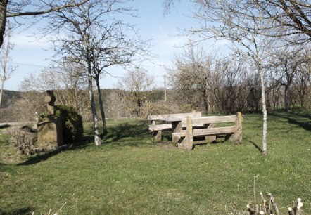
Rest area with wooden benches and a stone cross on a meadow, surrounded by bare trees under a blue sky., © M. Bach

Neidenbach N2

Lenght: 8 km
Route: Dorfbrunnen Ecke Densborner Straße, Kyllburger Straße to Dorfbrunnen Ecke Densborner Straße, Kyllburger Straße
Difficulty: medium

More information
Logo of the Eifelverein with stylized lines in blue, brown and green. Below it is 'Felsenweg' on a green background., © Eifelverein

Eifelverein - Felsenweg 12. Etappe

Lenght: 19.9 km
Route: Speicher Bahnhofstraße to Kordel
Difficulty: medium

More information
Old washing area with water basin, stone walls and steps, surrounded by green vegetation and trees., © Monika Bach

Neidenbach N4

Lenght: 5.3 km
Route: Dorfbrunnen Ecke Densborner Straße, Kyllburger Straße to Dorfbrunnen Ecke Densborner Straße, Kyllburger Straße
Difficulty: easy

More information
Logo of the Eifelverein with colorful lines and the lettering 'Willibrordusweg' on a green background., © Eifelverein

Eifelverein - Willibrordusweg 3. Etappe

Lenght: 11.4 km
Difficulty: medium

More information