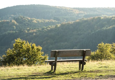
Regional hiking trails

Here you will find, among other things, a selection of hiking trails of the Eifelverein in the Bitburger Land. The trails are marked with a three-coloured "E" (blue: for sky and water; brown: for earth and soil; green for meadows and forests) on a white mirror; above it "EIFELVEREIN", below it on a green field the name of the trail.

This section also contains a selection of local hiking trails in the Bitburger Land holiday region.

mehr lesen

Share content:

Bitte akzeptieren Sie den Einsatz aller Cookies, um den Inhalt dieser Seite sehen zu können.

Alle Cookies Freigeben
Aerial view of the Bitburg reservoir with adjacent forest, buildings and parking lots. The sky is clear and blue., © team360 B. Treib

Biersdorf am See - "Merkeshausen" hike

Lenght: 11.9 km
Difficulty: difficult

More information
Wooden cross on a meadow with a bench, in the background a wide landscape and a village under a blue sky with clouds., © TI Bitburger Land

Biersdorf am See - Hike "Ringelstein

Lenght: 7.4 km
Route: Stausee Bitburg, Zur Rotlay, 54636 Biersdorf am See to Stausee Bitburg, Zur Rotlay, 54636 Biersdorf am See
Difficulty: medium

More information
A yellow rapeseed field stretches over a hill, surrounded by green meadows and trees under a blue sky with white clouds., © A. Girards

Hütterscheid "Echtersbachtal-Schleife"

Lenght: 22.6 km
Route: Hauptstraße, 54636 Hütterscheid to Hauptstraße, 54636 Hütterscheid
Difficulty: difficult

More information
Bitburg reservoir - start of the hike, © TI Bitburger Land

Biersdorf am See - Hike "Hermitage

Lenght: 4.7 km
Route: Stausee Bitburg, Zur Rotlay, 54636 Biersdorf am See to Stausee Bitburg, Zur Rotlay, 54636 Biersdorf am See
Difficulty: medium

More information

"Over the Mountain" Echtershausen

Lenght: 5.3 km
Difficulty: medium

More information
Stone chapel with pointed roof and weathercock, surrounded by trees and hedges, against a blue sky., © Conny Meier

Wanderweg Gindorf Gi4

Lenght: 8 km
Difficulty: medium

More information
Green meadow with scattered trees, in the background a dense forest under a blue sky with a few clouds., © Conny Meier

Wanderweg Gindorf Gi2

Lenght: 6.3 km
Difficulty: easy

More information
Vast landscape with golden grain fields in the foreground and a village in the background under a cloudy sky., © Conny Meier

Wanderweg Gindorf Gi1

Lenght: 3 km
Difficulty: easy

More information
The church of St. Apollonia in Gransdorf is enthroned on a wooded hill under a clear blue sky., © Doris Pauels

Apollonia Trail Gransdorf

Lenght: 2.7 km
Difficulty: easy

More information
Stone wall with a coat of arms of Gransdorf showing a church, two rings and a crown. A drainpipe can be seen on the right., © TI Bitburger Land S.Wagner

Gransdorf G7

Lenght: 4.4 km
Route: Dorfplatz, Brunnenstraße, 54533 Gransdorf to Dorfplatz, Brunnenstraße, 54533 Gransdorf
Difficulty: easy

More information